An Archaeological Landscape at the Foothills of the Tien Shan
Ravat is a landscape where the past is not hidden in a single find or monument. It is dispersed across fields, canals, burial mounds, roads, settlement mounds and traces of early iron production. This is why Ravat is one of the most fascinating areas of our research in south-western Kyrgyzstan. It allows us to explore how people in different periods used water, soil, raw materials and routes of movement and how these relationships gradually shaped a cultural landscape at the foothills of the Tien Shan.
Within a relatively small area, traces of ancient agriculture, abandoned irrigation systems, iron ore extraction and iron production can be found alongside settlement mounds, Scythian and Turkic burial mounds, a caravanserai, a historic communication route, structures associated with the period of the Kokand Khanate, and younger layers connected with a former Soviet state farm. The present-day village of Ravat is also part of this landscape, reminding us that this is not only a place of the distant past, but also a space where history, landscape memory and contemporary life continue to intersect.
Our aim is to gradually study, document and protect this landscape. Research at Ravat brings together archaeology, geoarchaeology, soil science, palaeoecology, geology, remote sensing and cooperation with local specialists. Each field season reveals another part of the story of how people in Central Asia used the landscape, adapted to its possibilities and left traces that can still be read today.
Ravat Research 2026
Water, Soil, Iron and Landscape
In summer 2026, our team will return to Ravat to continue research into this multi-layered archaeological landscape. We will focus mainly on the relationship between abandoned fields, irrigation canals, the soil record and traces of iron production.
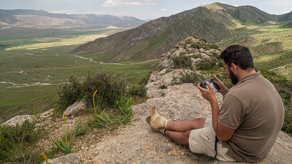
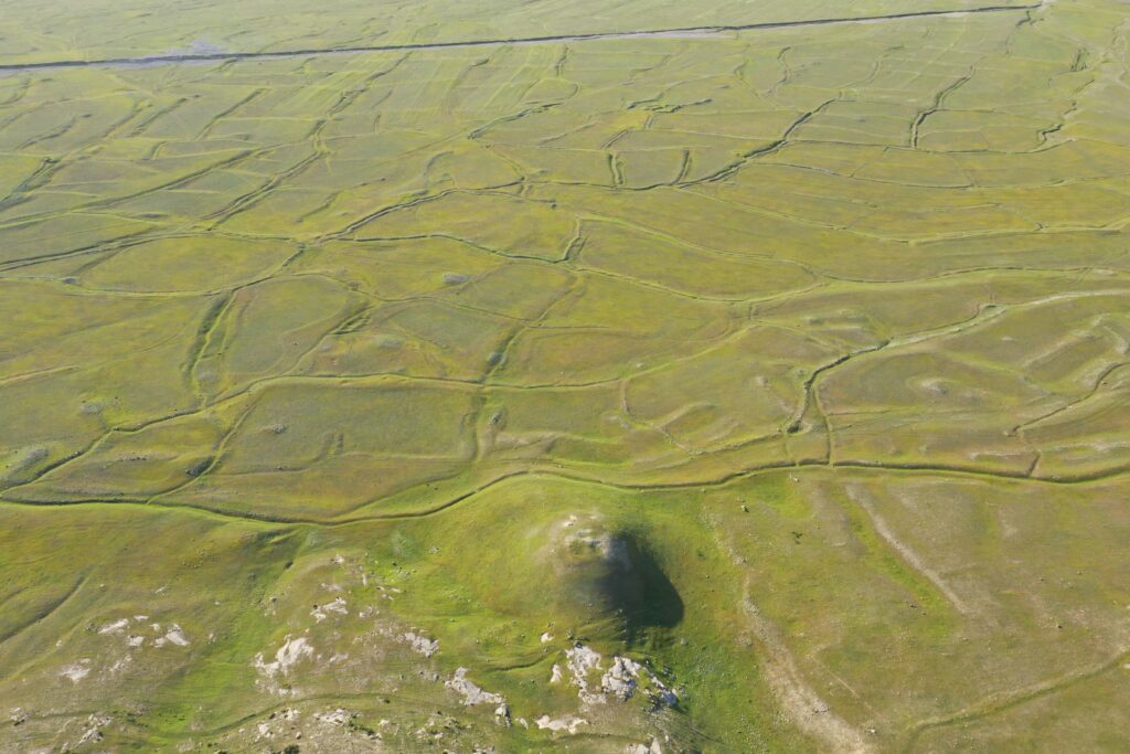
In the field, we will document the remains of the ancient agricultural landscape, the course of irrigation canals, settlement structures and iron-working features. We will use GPS, drone photography and photogrammetry to record individual landscape elements within their broader spatial context. The fieldwork will also include soil sampling for micromorphological, geochemical and palynological analyses. These methods can help us understand how the fields were irrigated and cultivated, and how the surrounding environment changed over time.
A separate part of the research will focus on iron-smelting furnaces, slag and the sediments around them. We are interested not only in iron production itself, but also in its relationship with the surrounding landscape: where the ore came from, how the furnaces were positioned, how metallurgical waste spread through the area, and where sources of fuel may have been located, including possible sources of lignite.
Contact: office@archeo.kg
Research Plan 2026
Fieldwork, landscape documentation, environmental sampling, iron production, water systems and the current Ravat 2026 research team.
▼ OPEN SECTION
In 2026, our work at Ravat will focus on the landscape as a connected system rather than on isolated archaeological features. Ravat preserves traces of settlement, water management, agriculture, iron production, communication routes and local knowledge. The main aim of the season is to understand how these different elements relate to one another within a landscape that was used and transformed over a long period of time.
A central part of the work will be the documentation of former agricultural systems, irrigation features and selected soil profiles. These remains do not necessarily belong to a single period. They may reflect several phases of land use, from prehistoric periods through later historical and early modern transformations. GPS recording, drone photography and field survey will help us place fields, canals and soil sequences within their broader spatial context. Carefully selected soil and sediment samples will later be used for micromorphological, geochemical, palynological and other environmental analyses, helping us understand how the fields were irrigated, cultivated, maintained and gradually transformed.
At the same time, the season will address traces of iron production preserved in the Ravat landscape. This work will focus on furnaces, slag, surrounding sediments and the possible relationship between production areas, raw materials, water, fuel and movement through the valley. We are interested in whether iron production was connected with the same landscape system as agriculture and irrigation, or whether it belongs to a different phase of use.
The research will also include the wider production and environmental setting of Ravat. This means documenting the distribution of metallurgical waste, observing how erosion and slope processes have affected the present-day visibility of archaeological remains, and recording possible evidence for fuel production or fuel sources, including charcoal production and potential local sources of lignite where relevant.
An important part of the 2026 season will be the collection of local knowledge about water, landscape and natural resources. Conversations with local inhabitants may provide information about water sources, former and present irrigation practices, seasonal flows, local place names, older land use and medicinal plants. These observations can help connect archaeological and environmental evidence with the way the landscape has been used, remembered and understood by people living in and around Ravat.
The results of the season should make it possible to compare several different layers of the Ravat landscape: agricultural fields and canals, iron-smelting remains and slag, fuel resources, erosion processes, water sources, routes of movement and local knowledge. This comparison is essential for understanding whether these elements belonged to one integrated system, or whether they represent different phases in the long-term use of the area.
Research Team 2026
Prof. Kadicha I. Tashbaeva
Head of the Department of Archaeology, Institute of History, Archaeology and Ethnology, National Academy of Sciences of the Kyrgyz Republic
Mgr. Atilla Vatansever
Department of Archaeology, Faculty of Arts, University of West Bohemia in Pilsen
Assoc. Prof. Lenka Lisá, Ph.D.
Institute of Geology of the Czech Academy of Sciences
Assoc. Prof. Aleš Bajer, Ph.D.
Department of Geology and Pedology, Faculty of Forestry and Wood Technology, Mendel University in Brno
RNDr. Marek Bastl, Ph.D.
Hulvát Brewery, Czech Republic
Mgr. Eliška Heppnerová
Teacher of Humanities and Natural Sciences at Nádražní Primary School in Horní Slavkov
Mgr. Zdeněk Heppner
Retired Teacher of Humanities and Natural Sciences at a Practical Primary School for Disadvantaged Children in Horní Slavkov
Mgr. Jozef Chajbullin Koštial
Department of Archaeology, Faculty of Arts, University of West Bohemia in Pilsen
Prof. Abdinabi Kadyrov
Batken State University, Kyrgyz Republic
Markéta Lisá
PORG Grammar School, Prague
Pavel Lisý
Institute of Geology of the Czech Academy of Sciences
Kuttubek Orunbai uulu
Osh State University, Kyrgyz Republic
Mgr. Martina Panero
Czech University of Life Sciences Prague
Mgr. Libor Petr, Ph.D.
Department of Botany and Zoology, Faculty of Science, Masaryk University, Brno