The current results of research into the topography of archaeological and modern settlements in the eastern part of the Fergana Basin were presented at the conference Computer Support in Archaeology in Broumov, Czech Republic.
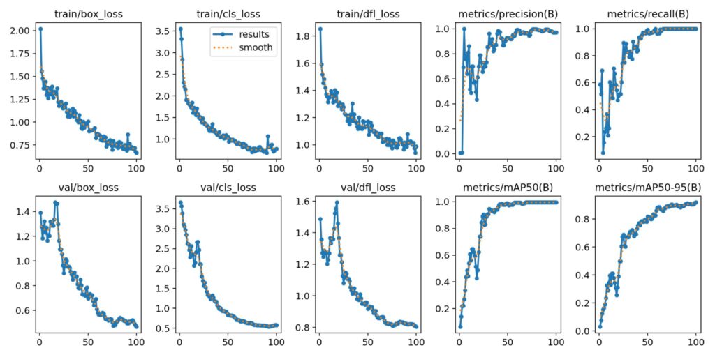
In accordance with the theme of the conference (AI in research), the results of training a spatial model for automatic detection of tepes and recent settlements were presented. Training of visual data (aerial images) is completed (Fig. 01 – statistical results of training and data validation) and a pilot deployment of the model for tepes prediction in the Osh region of Kyrgyzstan was carried out.
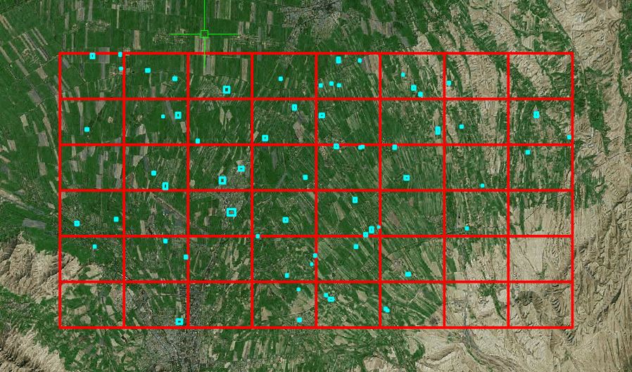
On an area of 600 square km, 64 new tepes were identified by this method (Fig. 02), which will be the subject of field verification (positivity vs. negativity of the presence of archaeological material). The results of building and training the model are now part of the publication efforts, which in case of a positive response will also be presented here on the pages of this portal.